My city INVISIBLE
COLOMBO
In loving memory of Nirmani Liyanage – urbanist, activist and educator. In times of crisis and change, few people show the courage and solidarity that Nirmani did. Always a voice for the marginalised, the forgotten, and the hidden people of Colombo, she stood at the vanguard of the ‘We Build Colombo’ campaign, and for the recent GotaGoGama protests for democracy and accountability in Sri Lanka. An excellent educator, Nirmani lived and taught from the university of ‘real life’, whether it was from the suburban slums of Wanathamulla or from the public protests at Galle Face. We will miss you Nirmani, but be assured that you leave a legacy of genuine commitment for justice that will carry on.
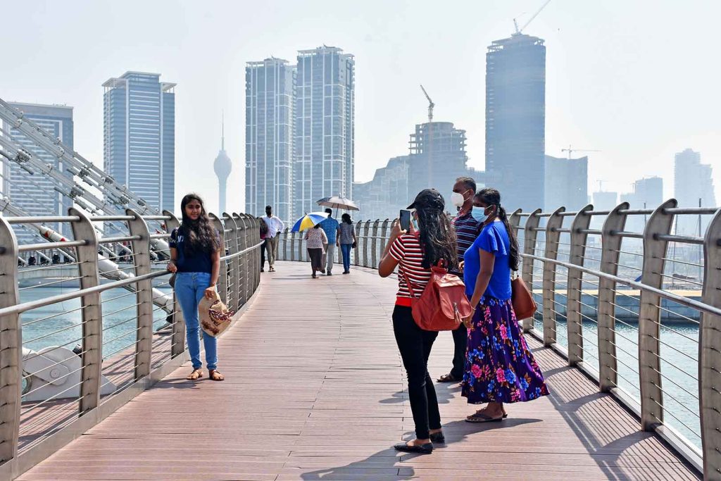
Colombo today
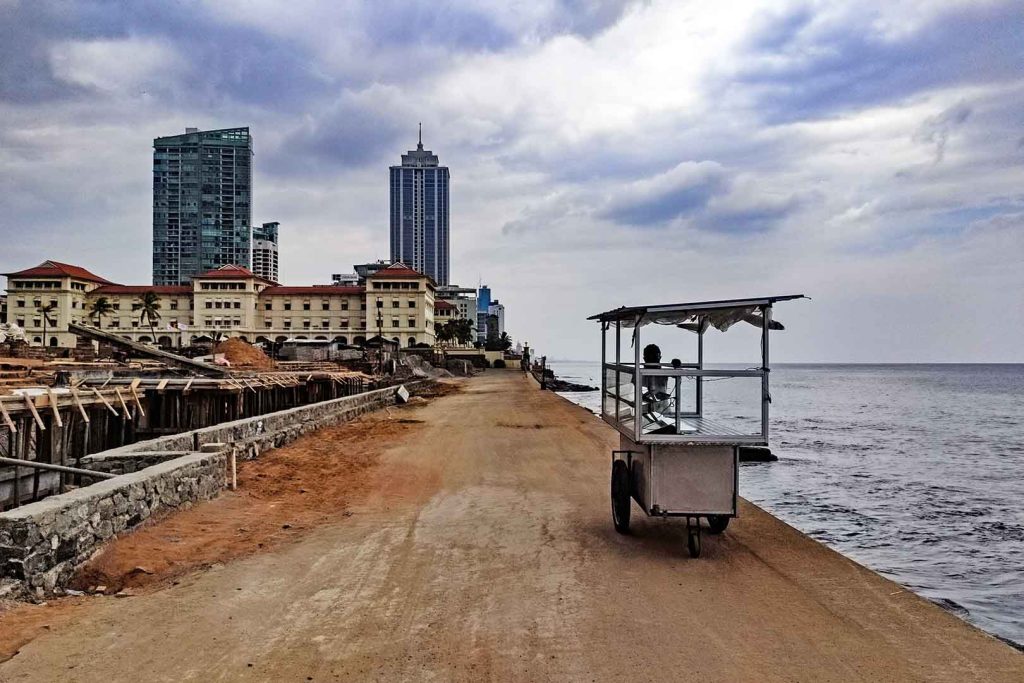
Colombo, once the capital of Sri Lanka, has been planned as a strategic and commercial global port. Tracing its origins to 16th century Dutch, Portuguese and later British colonial naval traders, the city is a colonial product. Hierarchically zoned, the most exclusive and densely populated zones are the waterfront areas in the northwest of the city. Colombo’s artificial harbour is surrounded by breakwaters, and the 160-acre peninsula area between the Galle Face sea front and the Beira Lake is called Slave Island or Kompannaveediya. Installed first by the Dutch and used until the abolition of slavery in 1857, Slave Island was set up as place of confinement and trade for East African slaves. In later years, it was repurposed as a base for soldiers brought in from Indonesia and other parts of South East Asia. Today, their descendants make up the ethnic Malay community, close to 0.2% of the overall Sri Lankan population.
After the end of the Civil War in 2009, Colombo was repositioned as the maritime capital of South Asia. This invited a huge amount of attention from foreign investors, particularly from China and India. An ambitious Commercial City Development Plan was introduced by Sri Lanka’s Urban Development Authority in 2019, which aimed to transform the sea-facing parts of Colombo to elite city fronts yards to attract businesses and luxury living. For the community of over 15,000 residents in Slave Island, these plans would bring unprecedented precarity and displacements. Slave Island lies in Zones 1 and 2 in the Colombo Development Plan, which aims to transform this densely populated area around Beira Lake into exclusive development without ‘slums’ and ‘ugly buildings’. So far, more than 500 families have been evicted from slave island by the Urban Development Authority, which was heavily militarised in the post-war years (Centre for Policy Alternatives, 2017). These families were promised resettlement in a TATA housing project in the Slave Island area, which never took off. Meanwhile, these families survive in poorly constructed temporary housing and make-shift homes on railway tracks (Razak and Bandaranayake, 2018).
Slave Island – History of the present
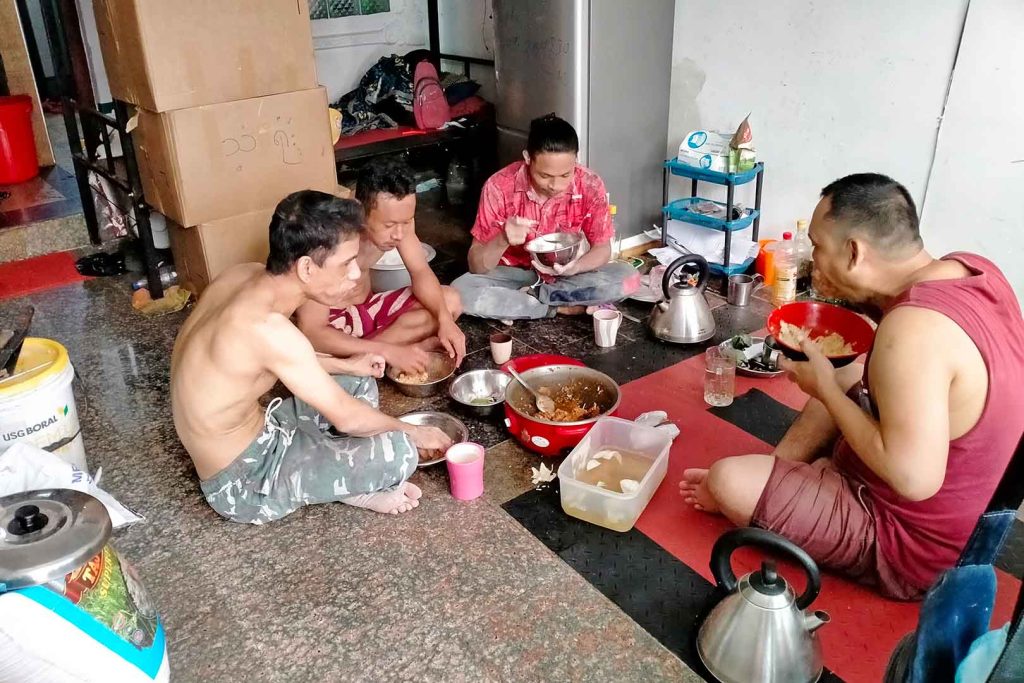
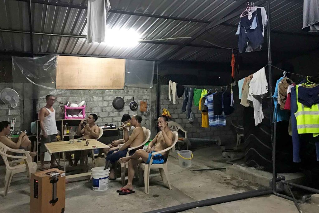
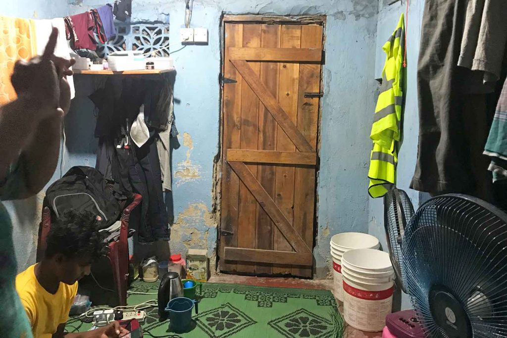
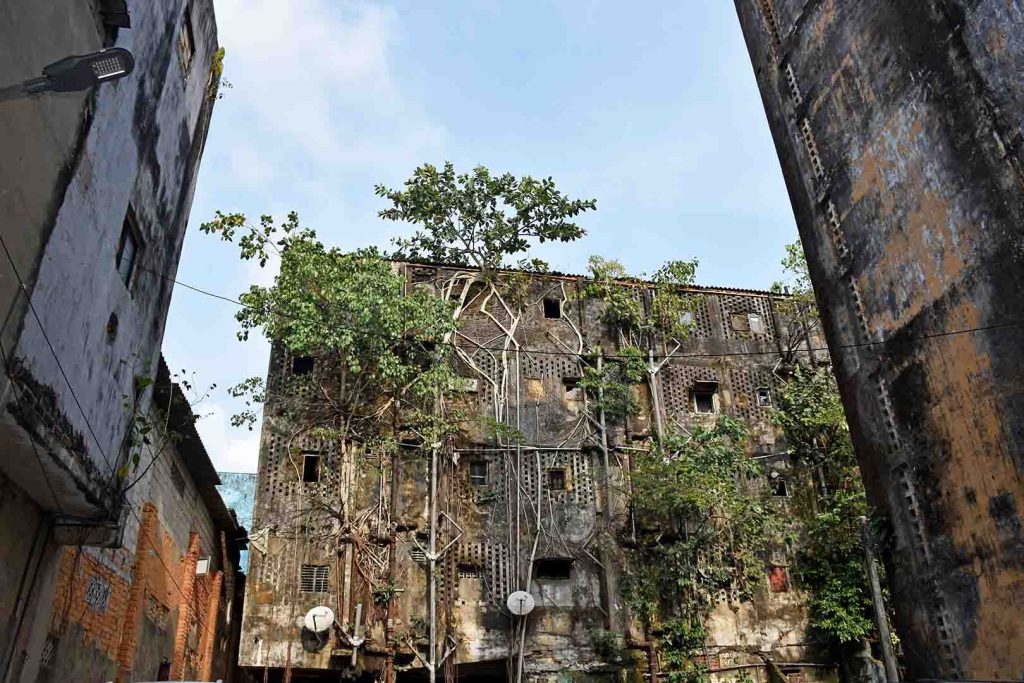
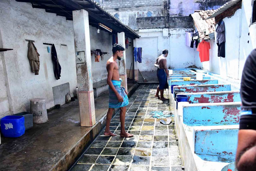
In official city development plans Slave Island is barely mentioned, and in public discourse it is described as densely populated and an unsightly and unsafe informal settlement. Notwithstanding the historical importance of recently demolished sites, like the de Soysa building and Castle Hotel, Slave Island has always been a place in transition, representing the human side of national infrastructure development. Half-built flyovers, part-demolished houses nestled between high-rises, alleys between shanty houses, food carts and wayside shops – amidst the permanent presence of bulldozers – echo the lives of the people who make the infrastructure on which the city survives. This photo essay reflects the lives of those inhabitants who are invisible in grandiose city plans. This includes the children of displacement who play and study in narrow alleys of Slave Island; the locals who have adapted to the entry of new Burmese and Vietnamese labour migrants alongside older migrants from rural Sri Lanka; and the migrants themselves who reproduce spaces for their recreation and community building. In its transience, Slave Island has stood steadfast as a crucible of multiculturalism, with Muslim Malay migrants, Hindu Tamils and Christians finding solidarity and safety in living cheek by jowl while the Sinhalese Buddhist majoritarian city threatens their very existence. Homes repurposed as boarding houses, food carts on Galle face, wood cutters adapting to the fuel crisis, public baths for men, dilapidated houses with clothes hanging to dry, and murals of long-term residents of Slave Island tell us who the real city is and what ‘inclusive’ planning could possibly look like.
Conclusion
This photo essay is the story of the Slave Island community, which has embraced change as a constant feature of their lives. As Sri Lanka grapples with the hollowness of post war majoritarian rhetoric, this community at the heart of Galle Face, where the democracy protests have taken root, reveals the city inside out. The migrants, the displaced people, the survivors; who continue to feed and fuel the city with infrastructure of survival and resilience.
References
Centre for Policy Alternatives, 2017. The Making of a World Class City: Displacement and Land Acquisition in Colombo. Colombo: CPA.
Razak, A. and N. Bandaranayake, 2018. The Tragedy of Wekanda. Sunday Observer, 29 April, 2018